Sunday 22 September 2013

The Great Circle Tour – A Retrospective

It started – and ended 8 days later – in Las Vegas.

Las Vegas

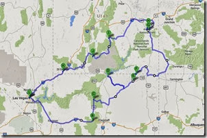
Grand CircleFirst, by the numbers:
Number of motorcycles - 2
Number of travellers - 4
Days on the road - 8
Days without rain - 2
Miles ridden - 1636
States visited – 5
National Parks visited - 5
Navajo Tribal Parks visited - 1
Photos taken – 2270(!)
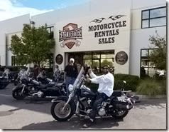
Now that we’re back home and getting over the jet lag and red-eye experience it’s time to look back on our trip and start the daunting task of wading through thousands of photos and dozens of video clips to try and reconstruct the highlights (of which there were many) of the past few days. But first I want to acknowledge the folks who made this possible for us – the people at EagleRider Motorcycles. FEagleRider Las Vegasrom the get-go they were helpful and accommodating to make sure we got the trip we wanted. The local staff in Las Vegas were efficient and friendly and the bikes were well-prepared and in good condition. The arranged accommodations were all easily accessible and well suited for biker travel. I can’t attest to EagleRider’s problem-handling capabilities as we didn’t have any issues but I would certainly use them again, they were great.
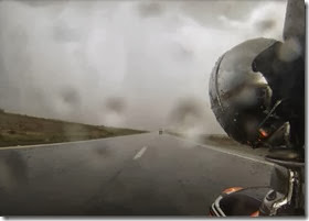
The weather. What is a motorcycle trip without weather? Being exposed to the elements is one of the factors that makes motorcycle touring what it is. That the elements may turn nasty on occasion comes with the territory. All week we were on the edge of those storms pounding parts of Colorado so we had more rain that we would have liked. But that was more from a road safety perspective than anything. Neither of us were that familiar with our bikes, especially under fully loaded LV Rainand wet conditions, and that was a concern at times when the weather got really heavy. But for the most part it was a minor irritant and actually lent some character to a lot of the places we visited. And the fact that there was a lot of cloud kept the desert temperatures to a reasonable level and reduced the risk of sunburn and/or heat stroke, so it wasn’t really that bad overall.
The geography. This entire area is simply mind-boggling. Never exposed to the grinding, crushing motion of the great glaciers this part of America was sculpted by different means and the results are at times surreal and always incredible. Every day brought something new and different and it was a thrill just to ride through it all. I certainly can’t do it justice with mere words and 2-dimensional photos so if you’ve never been to this area make plans to go now! You won’t be disappointed. But if you can, arrange to do so outside school holidays. The crowds were small most places but the ubiquitous rental RVs where everywhere and I can only imagine how painful it would be riding behind a row of 10 of those monsters being driven at 15 miles per hour under the limit through some of the canyon roads which we enjoyed in relative peace.


The bikes. As I noted before we had rented Electra Glides for this trip. While we both took some time to get comfortable with them (me more than my brother because he already rides a Road King) they turned out to be the perfect choice. At 75-80 mph on the highway they were as comfortable as sitting in your La-Z-Boy watching the world pass by on a big-screen TV. They just ate up the miles in total comfort for both rider and passenger and will be my bike of choice should I ever undertake such a trip again. In the city however, it’s a different beast entirely. Heavy and not very manoeuvrable (partly due to my lack of experience and fear of dropping “someone else’s” bike) it would be like owning a Humvee just to do the grocery shopping. Both low-mileage 2012’s the bikes were in good condition and created no drama – just the way we like it. 

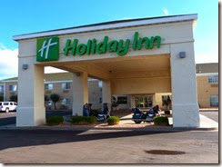
The accommodations. The hotels we stayed in were all middle-of-the road, Holiday Inn Expresses and their equivalents, basically the same quality of hotel we normally stay in when travelling on our own dime. As noted earlier they were all easily accessible from the route we were on so no driving around strange cities and towns looking for the hotel. With only one LV - Holiday Innexception all had breakfast included, one even allowing me to fulfill my annual craving for Froot Loops! Most were also located within easy walking distance of restaurants providing a choice for dinner and/or a local pub for a pint after a hot (or wet) day on the road. And best of all, all were very biker friendly with a couple even letting us store our bikes out of the rain under the front canopy. EagleRider chose their hotel partners well.
But too soon, the end. We’d had such a fantastic time we were all sad to see it end suggesting, only partly in jest, that we should see if the bikes would be available for another week. Perhaps there wouldn't be quite as much rain …
Wednesday 18 September 2013

Day 8 - It ain't over 'til it's over

On this, our last day, we expected a quick, straight shot into Las Vegas from St. George. But first we backtracked a few miles to Washington to visit Zion H-D for the requisite tee-shirts where we encountered a group of 20 or so riders from Japan, complete with an accompanying photographer. We would cross paths with them a couple more times on the way to Las Vegas and even had our pictures taken on the road, to end up in someone's electronic scrapbook or, more likely, in the bit bucket.

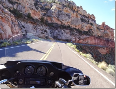
Back in St. George we picked up the ladies, checked out of our hotel, and hit the road on Hwy 15. Then we rode into the Virgin River Canyon. After all the riding we'd done over the past 7 days I think this was the best canyon riding of them all - 30 or so miles of high-speed curves, high canyon walls, and (again!) spectacular views. This bit of road by itself is worth a day trip from Las Vegas in my opinion.


By the time we exited the canyon the temperature was 100 degrees and there we encountered the long straight shot into Las Vegas. It was a very HOT ride and in less than an hour the initial symptoms of dehydration could be felt. But we were then in the outskirts of town and so pressed on to Eagle Rider to return the bikes before heading over to the strip to check in at MGM, which was to be home for the next 3 days.


And, sadly, that's then end of the adventure. We had a great time, riding good roads with great travel companions, seeing amazing sights and vistas long dreamed of, and taking hundreds of photos and hours of video which now have to all be viewed, culled, and edited.


Now it's time to start planning the next trip. Europe, perhaps.

Day 7 - A day of 'ests'.

This, our penultimate day on the bikes, turned out to be a day of extremes, from the coldest to the hottest, the highest, the longest, and the scariest. Fortunately it was not also the wettest as it turned out we only needed our rain gear for an hour or so at midday.


When we left Torrey at 7:30 AM it was less than 40 degrees and promising to get colder as we  climbed up the side of Boulder Mountain. A heavy dew the night before meant that the roads were still very wet. Feeling the air get colder as we climbed, combined with all the Icy Road signs, did not make for a very comfortable ride for the first while. The fact that cattle were wandering loose all over the road didn`t help either. However soon enough we reached the summit (9,600 feet) and started the ride down little knowing that the most interesting riding was yet to come.


Just south of Boulder you hit the 'knife edge' as the road follows the Hogsback Ridge. In places the road is a very narrow two lanes wide with a 3 or 4 foot shoulder on either side, then oblivion as the sides fall away hundreds of feet to the valley floor on either side. With no guardrails or other barriers to stop you, oncoming RVs hogging the middle of the road, and swirling crosswinds it's definitely a scary ride. You do not want to be less than 100% focused on your driving when crossing this ridge.


We continued through Escalante to Bryce Canyon where we stopped to view the hoodoos and take a short walk down into the canyon. Due to time constraints we only had a couple of hours to spend there but again we were blown away by yet another spectacular and completely different geography from what we had seen to date.


The rain and hail started as we left Bryce and stayed with us until we were a few miles from Zion. Again mother nature favoured us with nice weather when it really counted and it cleared up for our ride through Zion. Another gorgeous ride in a spectacular setting!


By the time we reached St. George it was well over 100 degrees, the highest temperatures we`d seen so far. We`d also done abour 260 miles, making it the longest day of our trip. Sadly it was also the second last-est day of what had been a phenomenal trip.

Tomorrow - back to Vegas.

Tuesday 17 September 2013

Day 6 – Move away from the rock


Since Arches National Park is literally in Moab’s back yard t back yard  National Park is literally in Moab'________________________________________________________________________________hat was the obvious place to start the day. The rock formations were, again, spectacular and completely accessible to the public if you wanted to walk a bit. And lots of people took advantage, crawling all over and through the famous arches posing for photos and just enjoying the beauty of the location. This is also where the best advice of the day, indeed the trip, was found. The sign said “If you hear loud cracking noises, move away from the rock.”  Seriously? People need to be told this? 


At the north end of the park we encountered the rain and hail we’d seen from a distance which then stayed with us for the next half-hour or so until we left the park.
The skies cleared as we took the scenic route 128 north to I-70. This road, also known as the Dinosaur Diamond Prehistoric Highway, runs through a narrow canyon alongside the Colorado River. At times you are literally riding 3’ from a vertical wall rising hundreds of feet overhead. Watch for falling rocks signs are everywhere but if any of those rock faces separate (which they do on occasion) a sign won’t do you much good. But it's a great ride and if you are ever in the area well worth the trip.
One other curiosity. Heading into the canyon from Moab you might experience an interesting optical illusion. It feels like you are actually going down into the canyon, but then you realize the Colorado River is meandering peacefully alongside the road. Where you expect to see rapids there’s nothing but smooth waters. At first I thought it was just me, but my brother also had the same experience.

All of the rain in the area caused numerous flash floods across the highways. They all left a residue of fine red sand on the roads which, when mixed with water (from yet another rain shower perhaps) turned to grease. We had a few scary moments crossing these flood areas as front wheels tended to go wherever they wanted and not necessarily where they were being aimed. Fortunately in every case we were across the slippery parts before any disasters occurred. 

Almost the same time we hit I-70 the rain (and hail!) started again with major lightning storms following us all the way into Torrey where we would stay the night.
Dinner that night was one of the best pizzas I’ve had in a very long time, washed down with a couple of glasses of Polygamy Porter (“Why have just one?”). Then it was back to the hotel as day 7 would need an early start.


Monday 16 September 2013

Day 5 – Friday the 13th


In honour of the Port Dover Friday the 13th celebrations which we were missing we all wore Friday the 13th tee shirts. Well most of us did; one person who shall remain nameless didn’t have one, an oversight to be corrected next summer.
Leaving Kayenta heading north on Hwy 163 we passed Monument Valley again. It was remarkable how different the rock formations looked in morning sun versus the late afternoon sun of the previous day. It’s easy to understand how serious photographers can spend days waiting for just the right light conditions because the subject changes so dramatically.

We then swung over on Hwy 160 to see the Four Corners Monument which commemorates the only place in the US where 4 states – Utah, Arizona, New Mexico and Colorado – all meet at one point. I expected something significant, but all it consists of is a concrete marker surrounded by the 4 state and Indian flags and numerous native artisans trying to sell their craftworks. And this after paying a $3/head admission fee and having to navigate a muddy gravel parking lot. Having seen how well the authorities had done up other points of interest I was quite disappointed in this site. Nonetheless we took the requisite photos and headed out.
North again on highways 491 and 191 towards Moab we stopped to spend a few minutes at Wilson Arch which was worth the stop for sure as it’s quite beautiful. 


Just as we were about to leave the arch the rain started again and chased us all the way into Moab. But the real heavy downpour, including 4” hailstones, kindly waited until we were checked into our hotel, which, conveniently enough, was located right across the street from the Moab Brewery and Restaurant. Of course we went there for dinner. The beer was excellent, the food was good, but the helping sizes were huge. In spite of our best efforts there were still some steak pieces and sausages left on our plates when we were done.  The waiter asked if we wanted carry-out. When we explained that we were in transit he then asked if we’d mind if he took them for a snack at “the big game” tomorrow.  That was a first for all of us but we said sure. We hope he enjoyed his leftovers.


Over dinner we reminisced about the day a couple of common observations arose. The most common was the wild variations we’d seen in the landscape that day. There was everything from the reds of Monument Valley to the really deep reds around Mexican Hat, the brown and gray rocky outcroppings to the lush fields around Cortez that could have been southern Alberta. And sometimes just one side of the road to the other would be totally different. It seemed every few miles brought something different to light,
Afterwards we went for a walk down the main street of Moab. It seems to be a very artistic/outdoorsy place and we discovered a great art gallery. This is where being on a motorcycle can pay for itself as there’s no room to bring “just the perfect thing for the garden” home. And I was careful to not point out the “We ship anywhere” signs.
The rain started again as we headed back to the hotel and the electrical storm and light show continued most of the night. It’ll be another wet seat on the Harley tomorrow.

Day 4 - A rain free day


The title reminds me of that old (bad) joke about 2 aged Harley riders who spent too much time saving lives (and damaging ears) with their loud pipes:
“Today was a rain free day.”
“Friday? No it’s not; it’s Thursday.”
“I’m thirsty too, when does the bar open?”
This was our shortest leg of the trip at about 100 miles over to Kayenta.
It was a beautiful morning, hot and sunny, as we stopped at the Page overlook to get a view of the Glen Canyon Dam. With clear skies the panorama option on our cameras got a good workout. Coming from a part of the continent where we’re surrounded by trees these wide vistas are truly remarkable.

Flooding had closed part of Antelope Canyon so we regrettably decided to pass on that and go directly to Horseshoe Bend Canyon. Here the canyon walls are several hundred feet high and you can look down into the canyon as the Colorado River meanders down to Lake Powell. As has been common on this trip there are no barriers and viewers can go right to (and over, one presumes) the edge. In fact some of the best photos are taken by crawling to the edge and hanging over with your camera aimed into the canyon. (Guilty, much to the distress of the spousal unit.) 

We spent some time at the lookout and then hit the road to Kayenta. We arrived before book-in time so decided to head up to Monument Valley (about 25 miles away). Having spent my formative years watching John Wayne and sundry other cowboy heroes catching the bad guys in Monument Valley this was a bucket list item for me. And it did not disappoint. Like the trip so far every location we’ve seen seems even more spectacular than the last. (“Spectacular” – that’s an adjective I’m trying to use less frequently but with little success as it’s the best I’ve been able to come up with, as inadequate as it seems most times.) 
After dinner that night we were entertained by an amazing light show as a major electrical storm created it’s magic over Monument Valley for an hour or more. I much prefer seeing it from a distance rather than up close and personal.
And we didn’t have our rainsuits on once!

Day 3 - The Road to Page


It was rainsuits on (Can you see the pattern here?) as we left Tusayan for Page via the Grand Canyon south rim route, highway 64. This route brings you back into the park and offers numerous pull-offs to stop and view the canyon from different vantage points. We made use of most of them. The canyon continued to awe, especially as it would disappear and then reappear as storm clouds moved through. While the inclement weather may have been inconvenient a park ranger expressed it best when he said these conditions were "special" in terms of seeing the canyon. (As a side benefit there were fewer people crowding the viewing locations.)


By the time we reached the tower at Desert View the rains had stopped except for a periodic sprinkle and stayed that way for the rest of the day.
The tower at Desert View is a man-made 70-foot tower on the edge of the canyon. Not sure that 70 feet adds much in terms of a vantage point when you’re already a mile above the canyon floor but clearly someone did. Regardless, it’s worth a quick stop to climb to the top and see for yourself.


 From Desert View the road quickly drops to the canyon floor offering yet another perspective on the canyon and environs. The loss of elevation is quite dramatic along the Little Colorado River Gorge until you reach Hwy 89 heading north to Page. By now you are in the Navajo Indian Reservation which, for those of you who care about such things, is dry, meaning no alcohol is sold or served on their lands. In other words, if you want a beer in your hotel that night, better stock up in Page (just outside the reserve).
Last February a portion of Hwy 89 up near Page collapsed and that highway is closed until further notice. So we had to detour further east and back-track along Hwy 98. It added quite a few miles to the day but it was still a beautiful ride through a gorgeous countryside. Very desolate though with few signs of life and no services anywhere along the route.  We found this to be the case throughout the area and so took every opportunity to gas up and take a pit stop. (There aren’t a lot of trees for the ladies to hide behind out here either.)
Approaching Page we were sure we were going to get a final soaking as a huge storm spanned the horizon in front of us, but every time we seemed to be getting close the road would veer off in another direction and we’d gain a few more miles. We checked into our hotel about 30 minutes before a severe weather warning was put on for the area and the storm finally hit just as we were comfortably having dinner in a local Italian food joint.
After it passed we picked up supplies for the following night (see comment above re dry) and headed back to our rooms. Tomorrow was going to be another full day so an early start was called for.